We’re starting another new series this week! We’ll be tracing the roots and routes of our town’s history and culture by featuring local stories and finding fun ways to connect them to our Glenwood RAGBRAI celebration! Today we start with the Missouri River Shipwrecks near our Tire Dip Site west of Pacific Junction! This piece comes from Ryan Roenfeld, an author, lecturer, and historian of the development of the mid-Missouri River region, Southwest Iowa, and 19th century gamblers and confidence men.
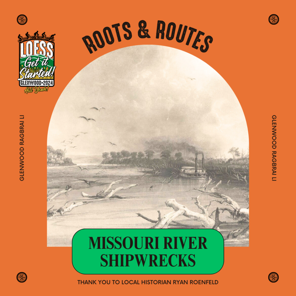
I’m not a wreck! You’re a wreck! And there sure were a whole lot of shipwrecks along the Missouri River. Yes, it really was called the graveyard of steamers and in the comments there is a map of the steamboats that sank in the river along the western edge of Mills County. Also see the Bodmer painting in our main picture for the reasons why. Yes, that’s what the Missouri looked like before the Pick-Sloan Plan created our modern drainage canal with a permanent nine foot navigation channel. Yes, the river is the way it is for barge traffic with flood control a minor issue.
The Missouri River here used to be almost a mile wide but was mostly shallow with lots of islands and those deadfalls called embarass, snags, and sawyers. The river flooded twice annually with the spring thaw here and then a later rise in June with the snowmelt from the Rocky Mountains. Even so, the Flood of 2019 was the worst flood along the Missouri River since the 1820s. Seriously. And that’s after spending how many billions of dollars?
Until the 1860s our local economy largely depended on the steamboats from St. Louis and a whole generation of “woodhawks” lived along the river to supply the steamers with wood to burn. The steamboat trade created the Mills County town of St. Mary and I wrote a little book about all that you can buy if you want to know more. Of course, river traffic went back and forth as well as up and down with river ferries in Mills County down at Thompson’s, the Mormons established the Bethlehem ferry in 1848, Sam Martin had the Platteville ferry, Peter Sarpy had the St. Mary ferry to Bellevue, and the Traders Point ferry kept going after Traders Point was mostly washed away. Plattsmouth, Omaha, and mighty Rock Bluff all owe their origins to those ferrying operations.
Here in Glenwood, the steamboats briefly made this town an outfitting point for those headed west to California, Oregon, or Utah or east to settle on the mostly unpopulated prairies of western Iowa. The steamboats landed at the place sometimes called Sharpsport or Sharpsburg right north of the present Plattsmouth bridge (site of our Missouri River Dip!) with goods then hauled to Glenwood along what used to be called the Dump Road along present-day Hawley and Hilman Roads.
The steamboats kept going north to Montana through the 1860s but the arrival of the railroads from Chicago in 1869 ended local river traffic almost entirely. Yes, the Richardson’s kept up the ferry to Plattsmouth until the automobile bridge was built but plans for a grain loading terminal along the river in Mills County proved to be just 1950s plans that never happened.
As for the steamers that sank in the Missouri around here, the Pochantas snagged and sank in August 1840, the General Grant was built for the Montana trade but was snagged and sunk in March 1866, the W.W. Walker was snagged and went down in 1874, the Mary McGee was a steam river ferry that sank due to ice in 1877. We should have kept the Native name for the Missouri, Pekitanoui, ’cause it sure is Troubled Waters.
If interested in finding out more – Captain LaBarge’s history of steamboat navigation is free online and I very strongly recommend the book on the Yellowstone written by none other than Glenwood native Donald Dean Jackson. Oh, his book Archer Pilgrim is a hoot too.
Thank you, Ryan!


Leave a comment